The Nebraska Farm Real Estate Market Survey and Report 2023-2024 provides insight on recent trends in the market value of land and cash rental across the state. Each year, the special feature section covers topics on new or emerging issues related to the agricultural land industry in Nebraska. These topics reflect the interest expressed by panel members and readership of the Nebraska Farm Real Estate Market Highlights Reports. The special feature section in 2024 focuses on trends and considerations for cover crops across Nebraska and implications on lease arrangements.
Findings from the 2022 Census of Agriculture in Table 1 provide an overview of the utilization of cover crops across the state's eight districts and 93 counties (USDA-NASS, 2022a, b). Approximately 925,686 acres of cover crops were grown on about 21 million cropland acres across Nebraska in 2022. Cover crops were planted on about 4.4% of cropland acres across the state by 4,477 operators.
In 2022, about 36,351 operators across Nebraska grew crops on about 21 million acres of land. Both the number of cropland acres and the utilization of cover crops greatly varied across each region of the state. Arid areas such as the Northwest, North, and South Districts grew between 53,069 to 92,422 acres. The Northeast, East, and Southeast Districts planted around 130,000 acres or more of cover crops. The number of operators in each region planting cover crops also varied. In percentage terms, the cropland operators planting cover crops varied from a low of 8.6% in the Northwest District to a high of 15.8% in the Central District.
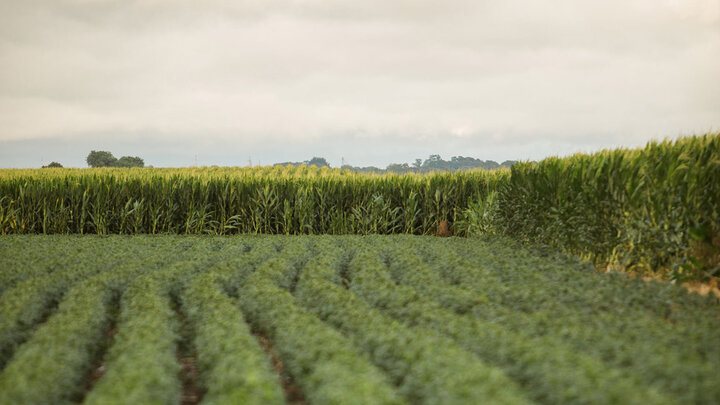
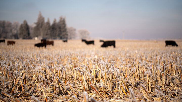
When planting a cover crop across Nebraska, the motivation of the landowner or operator may vary depending on the needs of the region or management requirements. Increased interest in cover crops in recent years has come from the perceived benefits to the land and mitigation of environmental issues. Cover crops reduce soil degradation (i.e. erosion) and enhance soil quality (i.e. organic matter and nutrient content). These effects may take multiple years to fully materialize but tend to persist for several years into the future. Grazing the cover crops or harvesting for forage are perceived as viable options for generating benefits on a more immediate basis.
The underlying motivation for utilizing cover crops remains important, as the operator may incur additional establishment and termination expenses for the land while the benefits may be spread into the future (Wallander, et al. 2021). Figure 1 summarizes the major reasons for planting cover crops across Nebraska.
Panel members reported that environmental benefits such as soil health and conservation accounted for about 56% of the reasoning or motivation behind utilizing cover crops. Livestock grazing and use as a secondary forage in a rotation accounted for an additional 32% of the reason for planting a cover crop on an agricultural property. The ability to obtain cost-share funding contributed to about 12% of the motivation behind adopting this practice.
Division of cover crop establishment expenses remains a provision to consider in a cropland lease arrangement (Bowman, et. al, 2024). Benefits from utilizing a cover crop may exceed the length of the current lease. Figure 2 summarizes the dollar per acre rental discount on a cropland lease provided to a tenant when planting a cover crop.
Panel members indicated that slightly over 68% of land leases do not provide a discount to tenants for planting cover crops. About 23% of leases offered a small discount between $1 to $9 per acre. Opportunities exist in lease negotiations to increase the equitability divide to cover crop expenses.
Survey results shown and discussed in this report are findings from the University of Nebraska–Lincoln 2024 Nebraska Farm Real Estate Market Survey. The survey's complete results can be found on the Nebraska Farm Real Estate website: cap.unl.edu/realestate.
Please address questions regarding preliminary estimates from the 2024 Nebraska Farm Real Estate Survey to Jim Jansen at (402) 261-7572 or jjansen4@unl.edu.
References
Bowman, M., Afi, M., Beenken, A., Boline, A., Drewnoski, M., Krupek, F., Parsons, J., Redfearn, D., Wallander, S., & Whitt, C. (2024, May). Cover Crops on Livestock Operations: Potential for Expansion in the United States, retrieved June 5, 2024, from the USDA-ERS.
USDA-National Agricultural Statistics Service (2022). Census Volume 1, Chapter 2: County Level Data, Nebraska, Table 41. Land Use Practices: 2022 and 2017, retrieved June 4, 2024, from the USDA-NASS.
USDA-National Agricultural Statistics Service (2022). Census Volume 1, Chapter 2: County Level Data, Nebraska, Table 45. Selected Operation and Producer Characteristics: 2022, retrieved June 4, 2024 from the USDA-NASS.
Wallander, S., Smith, D., Bowman, M., & Claassen, R. (2021, February). Cover Crop Trends, Programs, and Practices in the United States, retrieved June 7, 2024 from the USDA-ERS.
| Agricultural Statistics District | Planted Acres | Cropland Acres Planted to Cover Crops | Number of Operators | Cropland Operators Planted Cover Crops | ||
|---|---|---|---|---|---|---|
| - | Cover Crops | Cropland | Planted Cover Crops | Planted Cropland | ||
| - | ||||||
| - | Acres | Percent | Numbers | Percent | ||
| Banner | 2,335 | 184,737 | 1.3 | 7 | 179 | 3.9 |
| Box butte | 11,070 | 407,540 | 2.7 | 44 | 356 | 12.4 |
| Cheyenne | 816 | 546,240 | 0.1 | 13 | 537 | 2.4 |
| Dawes | 2,545 | 192,650 | 1.3 | 14 | 291 | 4.8 |
| Deuel | 410 | 191,547 | 0.2 | 11 | 168 | 6.5 |
| Garden | 961 | 160,334 | 0.6 | 12 | 192 | 6.3 |
| Kimball | 1,515 | 374,138 | 0.4 | 10 | 363 | 2.8 |
| Morrill | 9,235 | 268,449 | 3.4 | 46 | 374 | 12.3 |
| Scotts bluff | 12,692 | 216,092 | 5.9 | 107 | 564 | 19.0 |
| Sheridan | 11,020 | 293,604 | 3.8 | 37 | 404 | 9.2 |
| Sioux | 470 | 76,698 | 0.6 | 7 | 169 | 4.1 |
| Northwest | 53,069 | 2,912,029 | 1.8 | 308 | 3,597 | 8.6 |
| Arthur | 942 | 31,747 | 3.0 | 5 | 50 | 10.0 |
| Blaine | b | 21,181 | 0.0 | 1 | 50 | 2.0 |
| Boyd | 4,402 | 87,509 | 5.0 | 30 | 163 | 18.4 |
| Brown | 7,721 | 103,175 | 7.5 | 30 | 196 | 15.3 |
| Cherry | 6,790 | 435,881 | 1.6 | 19 | 390 | 4.9 |
| Garfield | 1,186 | 58,729 | 2.0 | 12 | 105 | 11.4 |
| Grant | b | 43,651 | - | 1 | 44 | 2.3 |
| Holt | 53,666 | 649,518 | 8.3 | 170 | 929 | 18.3 |
| Hooker | b | 8,526 | - | 1 | 18 | 5.6 |
| Keya paha | 4,671 | 108,625 | 4.3 | 26 | 131 | 19.8 |
| Logan | 2,930 | 30,406 | 9.6 | 8 | 54 | 14.8 |
| Loup | 1,926 | 20,272 | 9.5 | 14 | 60 | 23.3 |
| Mcpherson | 1,130 | 23,069 | 4.9 | 9 | 53 | 17.0 |
| Rock | 1,535 | 157,266 | 1.0 | 6 | 146 | 4.1 |
| Thomas | b | 7,981 | - | 2 | 35 | 5.7 |
| Wheeler | 5,523 | 97,537 | 5.7 | 22 | 127 | 17.3 |
| North | 92,422 | 1,885,073 | 4.9 | 356 | 2,551 | 14.0 |
| Antelope | 42,469 | 395,148 | 10.7 | 149 | 553 | 26.9 |
| Boone | 12,333 | 313,409 | 3.9 | 60 | 435 | 13.8 |
| Burt | 3,108 | 223,434 | 1.4 | 28 | 505 | 5.5 |
| Cedar | 7,825 | 376,702 | 2.1 | 98 | 721 | 13.6 |
| Cuming | 12,298 | 316,217 | 3.9 | 72 | 712 | 10.1 |
| Dakota | 1,405 | 153,895 | 0.9 | 8 | 203 | 3.9 |
| Dixon | 5,624 | 202,873 | 2.8 | 40 | 442 | 9.0 |
| Knox | 11,908 | 283,896 | 4.2 | 116 | 787 | 14.7 |
| Madison | 11,062 | 268,060 | 4.1 | 74 | 608 | 12.2 |
| Pierce | 16,463 | 211,550 | 7.8 | 68 | 437 | 15.6 |
| Stanton | 3,901 | 165,944 | 2.4 | 58 | 452 | 12.8 |
| Thurston | 5,221 | 142,379 | 3.7 | 22 | 222 | 9.9 |
| Wayne | 9,390 | 236,676 | 4.0 | 55 | 357 | 15.4 |
| Northeast | 143,007 | 3,290,183 | 4.3 | 848 | 6,434 | 13.2 |
| Buffalo | 19,730 | 382,339 | 5.2 | 99 | 799 | 12.4 |
| Custer | 27,864 | 576,202 | 4.8 | 133 | 795 | 16.7 |
| Dawson | 25,933 | 349,710 | 7.4 | 115 | 507 | 22.7 |
| Greeley | 10,009 | 80,639 | 12.4 | 41 | 183 | 22.4 |
| Hall | 9,178 | 234,815 | 3.9 | 48 | 454 | 10.6 |
| Howard | 12,591 | 141,653 | 8.9 | 74 | 400 | 18.5 |
| Sherman | 2,857 | 138,831 | 2.1 | 24 | 242 | 9.9 |
| Valley | 5,022 | 116,359 | 4.3 | 35 | 214 | 16.4 |
| Central | 113,184 | 2,020,548 | 5.6 | 569 | 3,594 | 15.8 |
| Butler | 25,851 | 315,127 | 8.2 | 100 | 618 | 16.2 |
| Cass | 11,248 | 275,446 | 4.1 | 69 | 609 | 11.3 |
| Colfax | 8,049 | 191,468 | 4.2 | 46 | 371 | 12.4 |
| Dodge | 6,326 | 312,885 | 2.0 | 45 | 622 | 7.2 |
| Douglas | 2,824 | 46,026 | 6.1 | 35 | 264 | 13.3 |
| Hamilton | 8,218 | 279,433 | 2.9 | 37 | 437 | 8.5 |
| Lancaster | 11,945 | 352,208 | 3.4 | 175 | 1,535 | 11.4 |
| Merrick | 9,882 | 164,234 | 6.0 | 43 | 388 | 11.1 |
| Nance | 7,002 | 90,151 | 7.8 | 35 | 214 | 16.4 |
| Platte | 12,629 | 377,553 | 3.3 | 71 | 782 | 9.1 |
| Polk | 5,472 | 193,724 | 2.8 | 44 | 392 | 11.2 |
| Sarpy | 1,553 | 52,414 | 3.0 | 19 | 272 | 7.0 |
| Saunders | 22,259 | 425,334 | 5.2 | 134 | 1,037 | 12.9 |
| Seward | 48,263 | 311,793 | 15.5 | 104 | 857 | 12.1 |
| Washington | 8,294 | 188,824 | 4.4 | 60 | 551 | 10.9 |
| York | 20,111 | 327,970 | 6.1 | 80 | 437 | 18.3 |
| East | 209,926 | 3,904,590 | 5.4 | 1,097 | 9,386 | 11.7 |
| Chase | 7,776 | 288,319 | 2.7 | 19 | 228 | 8.3 |
| Dundy | 8,613 | 180,904 | 4.8 | 19 | 195 | 9.7 |
| Frontier | 3,217 | 223,250 | 1.4 | 20 | 224 | 8.9 |
| Hayes | 2,357 | 162,198 | 1.5 | 13 | 206 | 6.3 |
| Hitchcock | 1,340 | 204,358 | 0.7 | 5 | 221 | 2.3 |
| Keith | 14,906 | 193,886 | 7.7 | 43 | 233 | 18.5 |
| Lincoln | 52,896 | 447,462 | 11.8 | 126 | 667 | 18.9 |
| Perkins | 7,584 | 443,531 | 1.7 | 36 | 324 | 11.1 |
| Red willow | 1,476 | 213,583 | 0.7 | 11 | 224 | 4.9 |
| Southwest | 100,165 | 2,357,491 | 4.2 | 292 | 2,522 | 11.6 |
| Adams | 9,434 | 296,355 | 3.2 | 48 | 399 | 12.0 |
| Franklin | 9,089 | 152,785 | 5.9 | 37 | 237 | 15.6 |
| Furnas | 5,691 | 287,435 | 2.0 | 19 | 316 | 6.0 |
| Gosper | 7,487 | 138,722 | 5.4 | 41 | 164 | 25.0 |
| Harlan | 3,928 | 169,819 | 2.3 | 29 | 242 | 12.0 |
| Kearney | 17,185 | 272,879 | 6.3 | 68 | 282 | 24.1 |
| Phelps | 15,194 | 243,469 | 6.2 | 54 | 295 | 18.3 |
| Webster | 13,797 | 222,111 | 6.2 | 52 | 277 | 18.8 |
| South | 81,805 | 1,783,575 | 4.6 | 348 | 2,212 | 15.7 |
| Clay | 23,447 | 302,950 | 7.7 | 63 | 399 | 15.8 |
| Fillmore | 17,103 | 335,849 | 5.1 | 50 | 438 | 11.4 |
| Gage | 23,955 | 458,558 | 5.2 | 127 | 1,020 | 12.5 |
| Jefferson | 6,555 | 225,103 | 2.9 | 45 | 476 | 9.5 |
| Johnson | 4,231 | 87,249 | 4.8 | 26 | 335 | 7.8 |
| Nemaha | 14,596 | 209,452 | 7.0 | 68 | 354 | 19.2 |
| Nuckolls | 3,960 | 220,855 | 1.8 | 35 | 301 | 11.6 |
| Otoe | 8,271 | 310,308 | 2.7 | 80 | 775 | 10.3 |
| Pawnee | 3,424 | 146,578 | 2.3 | 19 | 316 | 6.0 |
| Richardson | 11,987 | 256,485 | 4.7 | 62 | 648 | 9.6 |
| Saline | 5,291 | 248,656 | 2.1 | 39 | 602 | 6.5 |
| Thayer | 8,646 | 261,987 | 3.3 | 45 | 391 | 11.5 |
| Southeast | 131,466 | 3,064,030 | 4.3 | 659 | 6,055 | 10.9 |
| Statec | 925,686 | 21,217,519 | 4.4 | 4,477 | 36,351 | 12.3 |
Source:
a 2022 Census of Agriculture, National Agricultural Statistical Service, USDA.
b Value not released due to county-level disclosure.
c District values may not sum to state totals due to county-level disclosure.
Figure 1. Reasons for Planting Cover Crops on Cropland in Nebraska

Figure 2. Rental Discount in Dollars per Acre on Land Lease When Tenant Plants Cover Crops in Nebraska